
A full roof survey without setting foot on the roof.
A complete roof survey of Charnwood Primary School, captured in a single visit and delivered as a measured quantity schedule with survey-grade heights, so maintenance and design can be planned off real numbers rather than a ladder and a tape.
The school needed an accurate measure of a large, complex roof: total and per-section areas, gutter and penetration counts, and reliable levels across the whole structure. Getting that on foot means access equipment, working at height over an operating school, and still ending up with gaps.
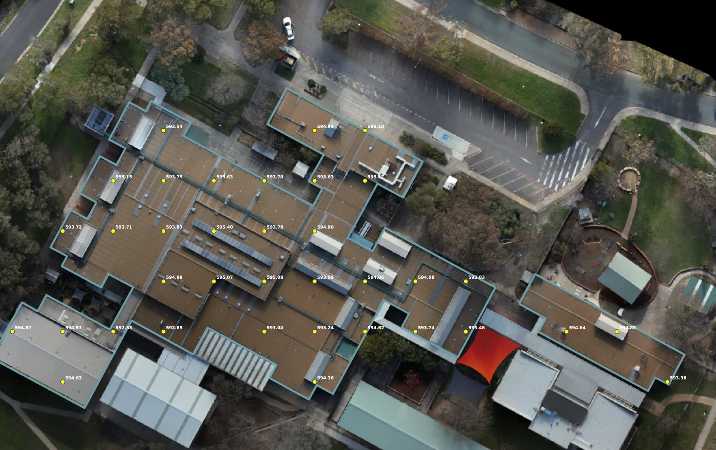
The roof was captured in one flight with LiDAR and high-resolution photogrammetry together. LiDAR carried the heights and the vertical faces, tied to ground control, while the 2 cm orthophoto carried the plan detail: outlines, gutters, spans, and fittings. Every roof section, box gutter, gable face, and penetration was traced and quantified, and 36 spot heights were placed on a roughly 12 m grid.
A single measured quantity schedule the school and its contractors can build from: 4,908 m2 of roof across main and secondary sections, 635 m of perimeter, 716 m of box gutters, and levels tied to a fixed datum to within 5 cm. Delivered with 3D linework in DWG and DXF and spot levels as CSV, ready to drop straight into design.
The kind of report the operator receives each period, shown here anonymised with illustrative figures.
From the capture set.
Have a project we should look at?
Tell us what you're trying to figure out. We'll be straight about whether a drone is the right tool.