
Measuring every stockpile on an active quarry.
A bi-annual stockpile volume survey across a working quarry, flown and processed so the site can reconcile what is actually on the ground against what the books say.
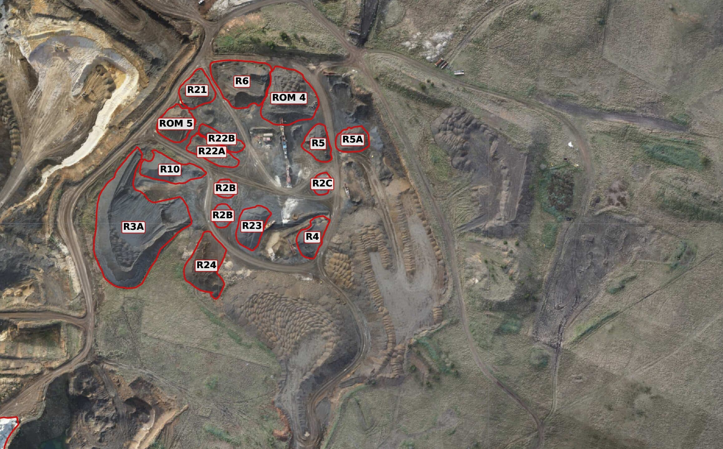
An operating quarry needs a periodic, defensible measure of its stockpiles. Ground survey across that many piles is slow and puts people on foot around live plant, and the figures age the moment the loaders move. The site wanted a repeatable cycle that produces the same numbers the same way every time, so successive surveys can be compared rather than argued about.
The whole site is captured in a single flight, 1,262 photos from a Zenmuse P1 with PPK corrected geotags, tied to surveyed ground control as an independent accuracy check rather than as the primary positioning. Each pile is clipped out of the digital surface model, a base surface is triangulated across its toe, and the volume is integrated between the two. Tonnage is converted at an agreed density so the figures stay continuous with the site's previous surveys.
A single sheet the site can work from: every pile outlined and labelled on a current aerial, with volume and tonnage listed against each one, and the accuracy figures attached so the numbers can be checked rather than taken on trust. Repeating the same method each cycle means the change between surveys is the real signal, not an artefact of measuring it differently.
From the capture set.
Have a project we should look at?
Tell us what you're trying to figure out. We'll be straight about whether a drone is the right tool.